 ADVNTR Road guide
Park Guide · Southern Utah, Zion Canyon and East Entrance
Zion National Park
A field guide to Zion’s canyon corridor, wilderness, Kolob Terrace, and east entrance, with the trails, activities, lodging links, seasonal decisions, and access details that shape a day in the park.
The Trailhead
Current conditions that may change your trip
Narrows and slot canyons close for flash flood risk
Zion closed the Narrows and every slot canyon Saturday as monsoon storms moved in — standard protocol, not an emergency, but it means the hike your whole day was built around might not happen. Have Zion Canyon or Angels Landing as backup.
See what changed →The point of this guide
A better trip starts with a better read of the place.
Zion is easier to understand as a set of connected but distinct days: the shuttle-served canyon corridor, permit-bound water and wilderness travel, the Zion-Mount Carmel route, and the higher, quieter approach through Kolob Terrace. This edition keeps those decisions together so the route does not collapse into a list of famous trails.
Inside the guide
What this guide helps you plan
Updated August 2026
Orientation
Read the park as a route system
A practical map-led orientation to canyon access, shuttle rhythm, east-entrance movement, and the separate wilderness and Kolob days.
Trails & routes
Choose the day before the trail
Riverside Walk, Emerald Pools, Kayenta, The Narrows, Angels Landing, and high-country routes with the permit and access decisions attached.
Field notes
Keep the operating links close
Lodging, camping, road restrictions, fire restrictions, shuttle information, and seasonal guidance stay connected to their official sources.
Before you go
A few practical truths, up front
Conditions and prices move. Recheck the official links before departure.
- Current conditions
- Recheck access, weather, and closures before departureCheck current conditions details →
- Permit boundary
- Angels Landing and The Narrows require separate planningCheck permit boundary details →
- Primary route
- Zion Canyon, Zion-Mount Carmel Highway, Kolob Terrace, and east entrance
- Guide format
- 33-page downloadable PDF
A look inside
See how the place and route fit together
A sample of the guide’s photography and route maps.
Field image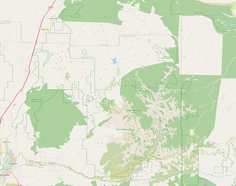 Route map
Keep it current
Check official conditions before you leave
Ready to plan the trip?